

SmartCity Budapest Transport

SmartCity Budapest Transport介绍
SmartCity is a totally free, OFFLINE public transport information application for Budapest. SmartCity offers a vector based map with address search, a public transport route planner and the full schedule of all the public transport lines of Budapest. The full functionality of SmartCity can be used offline.
Key features:
• Modern easy to use user interface based on out 6 years experience on mobile public transport applications.
• Offline full timetable of public transport lines including bus, metro, tram, train, suburban train and night lines.
• Timetable data based on the public official GTFS feeds of BKK ( Centre for Budapest Transport)
• Offline map based on OpenStreetMap data.
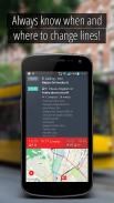
• Visualization of planned route on the map, with vehicle types and connections and visualization of any public transport line with stops
• Ease-of-use offline route planning from current position or from a selected location at any given time with alternative routes
• Offline address database for a quick address search and reverse geocode
• Using current time and position, the routes and timetables of near-by lines can be visualized
• Automated route planning to all favorite destination without network traffic
To use SmartCity Android 2.3 is required, Android 4.0 or better is recommended.
SmartCity的是布达佩斯一个完全自由的,离线的公共交通信息化应用。 SmartCity的提供与地址搜索,公共交通路线规划和所有布达佩斯公共交通线路的全部日程矢量地图的基础。 SmartCity的的全部功能可以脱机使用。
主要特征:
•现代的易于使用的基于移动公共交通应用输出6年经验的用户界面。
•离线公交线,包括公交车,地铁,电车,火车,郊区火车和夜间线路的完全的时间表。
•基于BKK的公职人员GTFS供稿时间表数据(中心布达佩斯运输)
•基于OpenStreetMap的数据离线地图。
•在地图上规划路线的可视化,与车种和连接,并停止任何公共交通线路的可视化
•易用性使用离线路径规划从当前位置或从选定的位置在与备选路线任意给定时间
•一个快速搜索地址和反向地理编码脱机地址数据库
•使用当前的时间和位置,逐线附近的路线和时刻表可以可视化
•自动路线规划给所有喜爱的目的地没有网络流量
要使用SmartCity的Android 2.3的要求,搭载Android 4.0或更好的建议。


